Unchecked growth in Bhiwandi and Thane raises questions of flood risk
Thousands of warehouses have sprung up in Bhiwandi in the past few years to serve e-commerce giants like Amazon and Flipkart. Much of the land on which these structures stand was completely submerged in the deluge of July 26, 2005.
Since that fateful day, authorities in the region have made an effort to reduce waterlogging and improve disaster management. But the macro measures of risk mapping and flood zoning remain incomplete—a glaring gap that puts the Mumbai region at risk.
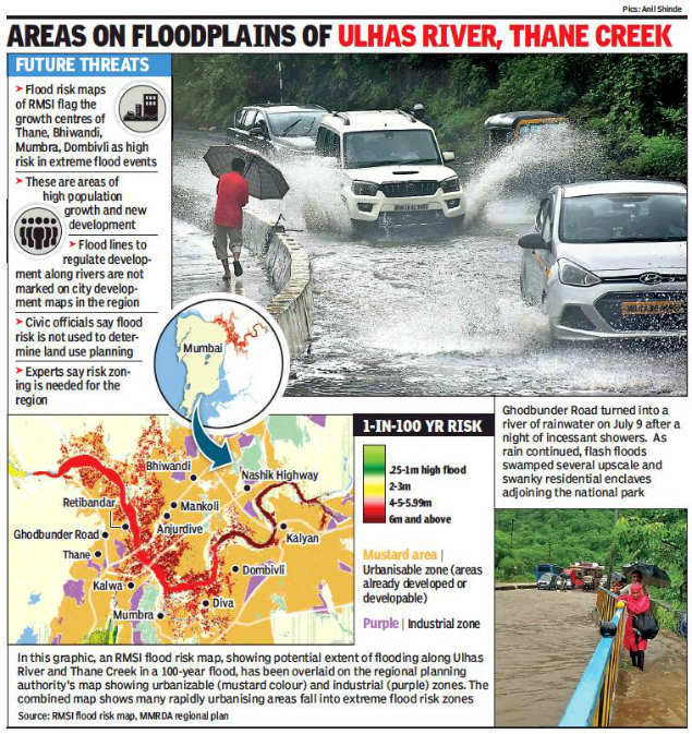
The hazard is evident in flood risk maps provided by RMSI, a global natural hazard consultancy, which flag the vulnerability of Bhiwandi, Thane, Mumbra, and Kalwa to extreme floods. These towns not only lie on the floodplains of the Ulhas River and Thane Creek but host much of the region’s recent urban growth. In Thane, for instance, officials say Rs 100-crore-worth of projects have been cleared for the Ghodbunder Road area in the past five years.
“A lot of risk is getting accumulated in these areas,” says Pushpendra Johari, head of Risk & Insurance at RMSI. None of these areas is zoned for flood risk in the region’s city development plans, whether Mumbai, Thane, or Bhiwandi, say officials. This lacuna exists despite an almost 30-year-old state regulation mandating the mapping of river flood lines and corresponding regulations (see box).
The only significant buffer from the river today is provided by coastal regulation zone (CRZ) rules, which restrict development near the high tide line. This rule too is set to be relaxed.
The lack of flood land-use zoning persists despite recommendations by the Chitale Committee Report on the 2005 floods. “Flood zone regulations for land use patterns are a must along river channels,” it said.
Ideally, flood risk maps should also be made available to the public, says TI Eldho, head of civil engineering at IIT Bombay. “When the public buys a flat, they should be able to check where it falls in the flood zone,” he said, adding. “But obviously that puts builders at a disadvantage.”
As in Mumbai, the Thane municipality uses flood risk maps to make decisions on storm water drains and roads—but not to determine land use planning. Officials said that only CRZ norms currently determine building permissions near the river.
The problem: CRZ buffers do not guarantee flood protection. “CRZ is concerned with coastal ecology not flood risk,” notes V K Phatak, former chief planner of the Mumbai Metropolitan Region Development Authority.
It was for this reason that a hazard line concept was introduced into CRZ rules in 2011—in order to deal with vulnerability to natural disasters. But the line has yet to be finalized and published. And the most recent CRZ amendments dilute hazard criteria, says Debi Goenka of the Conservation Action Trust. “Demarcating a hazard line would obviously have implications for planners and builders,” he said.
Regionally, there has been some effort to tweak building laws for flood risk. Mumbai’s new development rules say building plinth must be above high flood level. Bhiwandi’s new rules, formulated by the MMRDA, mandate set distances from nullahs and plinth heights in flood-prone areas.
Meanwhile, existing development finds ways to cope with routine flooding. At greatest risk are the shanties coming up in Mumbra-Diva. According to an official affidavit filed in the Bombay high court, 11 hectares of mangroves in the area have been lost to illegal construction. Thane’s gated complexes are insured and built with precautions. Still, Hiranandani Estate residents said they experienced waterlogging in 2016, while Lodha Paradise was affected by heavy rain last year. The complexes cleaned up nullahs and leveled the ground to mitigate the problem.
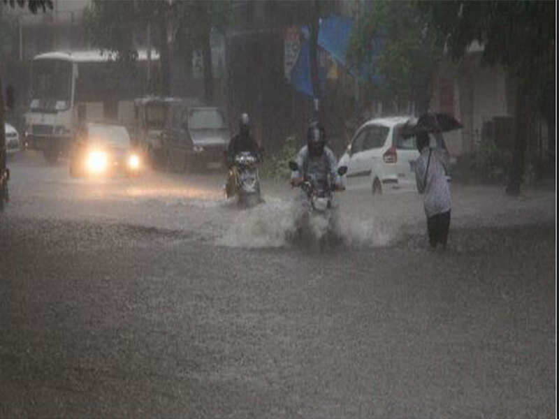
As builders raise ground levels, though, flood waters can invade other areas. “We are seeing more water in our neighbourhood after nearby complexes raised levels,” said Rohit Joshi, a Thane resident. Villages close by get flooded too, he added. And Ghodbunder Road, stuck between the hills and a river, last month turned into a waterway.
Back in Bhiwandi, most big warehouses are built on raised ground with robust drainage and tall steel racks to keep goods safe. But transport can be an issue when roads are flooded. And waterlogging is an annual irritant for smaller godowns and factories. Private insurers see Bhiwandi as a problem area, best avoided.
What happens if there’s another 26/7? “We’re keeping our fingers crossed,” said a godown manager, who asked not to be named.
(With inputs from Freny Fernandes & Pradeep Gupta)